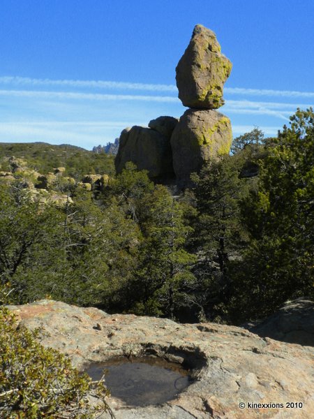
Showing posts with label Chiricahua. Show all posts

Monday, May 10, 2010

The Real Unfinished Business at Chiricahua

At Chiricahua there are a series of trails that when combined will take you from Massai Point or Echo Canyon down to the Visitor Center 6.3 miles and 1,380 feet below. In addition, there are two spur trails of a mile each, making the trek 8.3 miles long (actually 8.5 including the half-mile trail from the Visitor Center back to the campground). And, this is why I returned to Chiricahua. When I was there in March, the thought of making such a long hike (it seemed long to me at the time) was daunting. That, and the fact that much of the trail was downhill didn't sink in until after I had left!

First, a shuttle bus takes you to the starting point, bright and early at 8:30 in the morning. It's about a 20 minute ride to Echo Canyon where I started out. From there it is a short walk to the Ed Riggs Trail, which connects to the Mushroom Rock Trail, which connects to the Big Balanced Rock Trail, which connects to the Sarah Deming Trail, which connects to the Lower Rhyolite Canyon Trail, which (finally) takes you to the Visitor Center. (Ah, the genealogy of a hike!) At the intersection of Mushroom Rock and Big Balanced Rock is the spur trail to Inspiration Point. Then midway along Big Balanced Rock Trail is the Heart of Rocks Loop.

Of course, there are some people that start this hike from the Visitor Center and go UP to Massai Point. However, I wasn't one of those people, besides why go up when you can just as readily go down? (Since there are so many images in this post, they have been made smaller. Please click on an image to view a larger version.)

The Ed Riggs Trail, which is only .7 miles long, quickly drops you into the canyon while the Mushroom Rock Trail gains 610 feet in elevation in 1.2 miles. It's a bit like a roller coaster, albeit a very slow moving one! Like most of the trails at Chiricahua, these were rocky. Very rocky.

Mushroom Rock.

Nearing the end of Mushroom Rock Trail.

The trail to Inspiration Point is mostly level, which was a welcome change after the ascension of Mushroom Rock Trail. Inspiration Point offers stunning views of the valley, providing a slightly different perspective than what is seen from Massai Point.

The incredible view from Inspiration Point.


Several of the formations along Big Balanced Rock Trail.

A sign posted beside the path says that Big Balanced Rock is 22 feet in diameter, 25 feet in height, and weighs 1,000 tons. (Wow. That's two million pounds! Wonder how they weighed it?)

A portion of the Heart of Rocks Loop. That's the trail, going through and over the rocks!

The trail guide says “The Heart of Rocks Loop has many of the most unusual rock formations to be found at Chiricahua.” It also says to “Start the loop to the left and hike clockwise for the best views and easiest walking. Lots of rock steps make this a challenging loop, but it's worth the effort.” Challenging? I'd have to say that the Heart of Rocks Loop is the most difficult, challenging, strenuous one-mile trail I've hiked. And other campers at Chiricahua that I've talked with who have done it, agree with that assessment. It is tough. But, oh, was it fun!

Camel's Head.

Duck on a Rock.

More formations in the Heart of Rocks Loop.

A short distance after returning to the Big Balanced Rock Trail you connect to the Sarah Deming Trail, which is 1.6 miles of rocks. Big rocks. Little rocks. In-between rocks. The Sarah Deming Trail rocks!

It seems like forever, but you will eventually arrive at the Lower Rhyolite Canyon Trail, which takes you (where else?) through the lower portion of the Rhyolite Canyon. There is also an Upper Rhyolite Canyon Trail that would take you up into the canyon to connect to two other trails, which would take you back up to Massai Point. But I was going down, thank goodness!
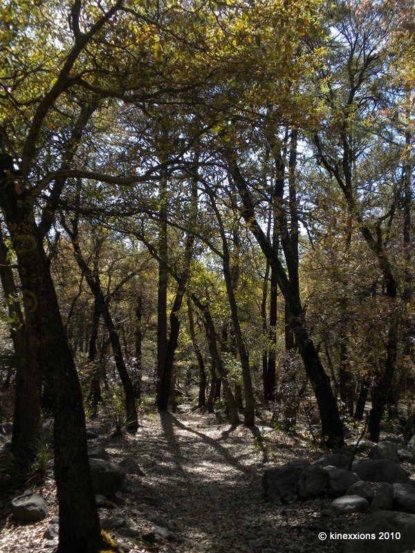
When you get within a mile or so of the Visitor Center, the trail is (literally) a walk in the woods. And oh so refreshing after hiking all day in the sun!

As you can see from these photos, the terrain is quite varied. You get up close and personal with some of the stone formations. It was a most interesting day. My feet hurt. My legs were sore. My curiosity was satisfied. I was pleased that I had returned to Chiricahua. But most of all, I was very happy when I made it back to my campsite!

Sunday, May 09, 2010

A Monster at Sunset...

One evening I drove up to Massai Point (6,883 feet above sea level and one of the highest points in Chiricahua National Monument) for the sunset and played with some shots of one of the stone formations...

The glowing “eye” sure made it look creepy.

But the glowing mouth was really weird.

Walking off into the sunset...

Sure doesn't look the same in the light of day!

'Twas another glorious sunset!

Saturday, May 08, 2010

Unfinished Business at Chiricahua

Just in case you might not have noticed, I was fascinated with Chiricahua National Monument and its myriad stone formations. Having spent four days there in mid-March and going away without having attempted the longer trails, I “had” to return to complete them. Besides, it really is a nice place, one of my favorites thus far.

Except for that first day, the weather for the remainder of my second stay at Chiricahua couldn't have been better. Daytime temperatures were in the mid-70s and at night it didn't fall below 40. I had blue skies and sunshine for the next five days (April 24th through the 28th).

The Natural Bridge Trail, is 2.4 miles long. You return on the same trail you went out on, thus the round-trip is 4.8 miles. It takes you up through a canyon, down the other side, and around to another canyon. It is an up-and-down trail, relatively easy walking, with sand and rocks, but some level stretches also.

When you get into the other canyon you are taken through a forest of pine trees and then up a short distance on the canyon walls. The destination, the Natural Bridge, is somewhat underwhelming. It is quite a ways away across the canyon. Still, it is quite a nice hike. You get some good views of the desert floor below and other mountains in the distance as well as of many weird stone formations and the occasional desert flower.

These fellas greeted me as I walked to the trailhead of the Natural Bridge Trail. They really weren't all that friendly though, they didn't say a word as I walked by, just glared silently!

The desert and another range of mountains off in the distance. The trail went through the forest of trees to the left after descending into a second canyon.

Can you see the Natural Bridge? It's there in the middle, right below those clouds. Really.

Okay, here's a close-up view... it is still underwhelming.

Beautiful Cactus Flowers. The only ones I saw on the trail (or anywhere else in the park for that matter).

Friday, May 07, 2010

Chiricahua Revisited

As I drove south the morning of April 22nd the weather was nice. I was even greeted by a few wild flowers blooming along the side of the highway.


But you see those clouds in the distance. Not a good sign. Nope, not at all... Stopping briefly in Willcox, I continued on to Chiricahua. I got to the turn off to the park, saw the dark clouds hanging low over the mountains four miles away and quickly turned around and went back to Willcox. I knew that the campground was in a canyon beneath a canopy of trees that provided a good deal of shade. Seeing that layer of dark clouds overhead, I also knew that there would be no sun penetrating into the valley.

I ventured a few miles to the west, over the next range of mountains, to the town of Benson where I knew there was a State Park (Kartchner Caverns). When I got there, the weather looked good. It was relatively warm and the sun was shining. However, before long that changed. The dark clouds moved in as did the rain – the campground host said there was a possibility of snow that night!

The view from the van, near dusk. It was getting cold.

And this is the next morning, after I had cleared off the windows, which were caked with heavy, wet snow. It was just cold enough to make it uncomfortable. I left Kartchner Caverns a few minutes after this picture was taken. I stopped to use the internet and checked the weather....with the forecast in hand, I returned to Chiricahua National Monument.

The mountains along the highway to Chiricahua were topped by a layer of clouds, but blue sky was starting to make an appearance, as was the sun!

The view from Faraway Ranch in Bonita Canyon at the entrance to Chiricahua National Monument, taken in early afternoon of April 23rd. As I set up my tent, there was a brief sprinkling of a rain-snow mix but not enough to cover the ground. Within two hours the clouds had nearly cleared up and the sun was shining. It turned into a beautiful day!

By evening, the clouds had moved back in, making for a dramatic sunset with the distant mountains as a backdrop.

Thursday, April 01, 2010

Chiricahua National Monument

If you should happen to be driving along Interstate 10 in southeast Arizona, you need to turn south onto highway 186 in Wilcox. Your destination is a little over 30 miles through the desert, uphill. It is the same terrain you have been driving through from Texas and New Mexico and you're wondering why or how this will be any different. But when you reach the little road that takes you into a canyon, you enter a different world. A delightful, surprising one.

There was green grass. And trees. Not just the little scrub bushes but real trees. And it was cool. And there was a stream with flowing water. Of course, it was early spring. There had been a lot of snow during the winter and it was melting. The first time in many years that there had actually been water flowing in Bonita Creek, according to one of the Park Rangers.

This fascinating place is Chiricahua National Monument. I had never heard of it until I saw a sign on the Interstate. I'm so glad that I took that road. The campground was pleasant with some sun making its way through the trees. It was refreshing to return to after several hours of hiking the trails, which were created by the Civilian Conservation Corps in the 1930s.

My Campsite.

The Erickson/Riggs home at Faraway Ranch, Bonita Canyon.

In 1887, this remote canyon became the home of Neil and Emma Erickson. Swedish emigrants, they met at Fort Craig, New Mexico. He was a sergeant in the Army and she was a a maid and companion to the Colonel's wife. Neil was often away from home, working, and Emma tended to the children and the ranch. In 1903 he became a forest ranger, which took him further away from Bonita Canyon. In 1917, the eldest daughter, Lillian, began inviting guests to the ranch and it became the getaway destination. Her husband, Ed Riggs, became foreman of a CCC Camp and helped build the trails used by visitors today. They did an amazing job on the trails. Faraway Ranch is now a part of Chiricahua National Monument.

Beyond Bonita Canyon are the mountains. The trails wind through the incredible rock formations – pillars and balancing rocks galore! It is a wondrous place, indeed.