Showing posts with label Mt Rainier. Show all posts

Saturday, September 26, 2015

Mount Rainier : Grove of the Patriarchs - August 8th

Each time I had come into Mount Rainier National Park, the parking lot for the "Grove of the Patriarchs," near the Stevens Canyon entrance on highway 123, was always full. But I arrived before 9 a.m. this morning and easily found a space to park.

Probably one of the easiest hikes in the park, the one-mile long trail takes you through an old growth forest, over a short suspension bridge, and onto an island in the middle of the Ohanapecosh River.

A short distance along the trail I came across this family "holding up" the tree. I offered to take a picture including the lady with the camera, but she said "No. We take this picture every year with the people in the same position!" What a fun thing to do, I thought.

I walked along the trail for a while with this lady and the lady she was with. They were from Nebraska on their way to visit friends in Tacoma.

This little girl was waiting for the rest of her family. She had been running around on the trail and apparently got tired. She gives some dimension to the size of the roots of the fallen tree.

An "artistic" rendering of someone crossing the river on the suspension bridge. The lighting was perfect for an instant!

I stopped at Box Canyon again. When I was here a couple of days ago the river was in deep shadow and barely visible. Here, on the south side of the bridge, it is 180 feet down to the river.

While on the north side, it is only 115 feet to the river.

At "The Bench" viewpoint after passing through Stevens Canyon. I sat here for over an hour just watching the clouds pass by, sometimes hiding the mountain, as above, other times exposing bits and pieces. And the cars. It was surprising to me how few of them stopped. And how few of the people in those cars actually got out of them when they did stop! The thing is, coming in from the east you don't even see Mount Rainier. And after going around the curve in the middle of the photo you don't see it either, unless you happen to glance in your rear view mirror at just the right time!  It was an interesting spot. Enjoyable sitting in the sunshine but quite cool when the wind picked up.

In the post "Travel Update... Glacier National Park" I mentioned that the windshield, on the passenger side, had been chipped driving through a construction zone in Iowa. One of the tendrils had been slowly migrating toward the rear view mirror. Upon leaving and heading back to the campground I noticed that tendril had lengthened to just beyond the rear view mirror into the drivers side. It now extended over halfway across the windshield. Earlier in the day it had only been about 8 inches long. And two of the other 6 or 8 small tendrils had also begun to lengthen, just while I was at the overlook. One was moving up to the top of the windshield and the other down toward the bottom. I'm guessing it was because Van Dora was facing south and the heat from the sun caused them to begin migrating. I couldn't feel any of the cracks, inside or out, but decided it was probably time to get the windshield replaced.

Published under a Creative Commons License.
Becky Wiseman, "Mount Rainier : Grove of the Patriarchs - August 8th," Kinexxions, posted September 26, 2015 (http://kinexxions.blogspot.com/2015/09/mount-rainier-grove-of-patriarchs.html : accessed [access date])

Sunday, September 20, 2015

Mount Rainier - August 6th

It was about a 40 mile drive from Iron Creek Campground to the Stevens Canyon Entrance on the southeast side of Mount Rainier National Park but I really didn't mind the drive since the campground was especially nice.

Mount Rainier seen from the Box Canyon Trail.

And from "The Bench" after passing through Stevens Canyon.

A zoomed-in view of the snow-covered peak of Mount Rainier.

Louise Lake.

Reflection Lake. I talked briefly with a hiker from Ohio who was in his tenth day of hiking the Wonderland Trail. In my mind, that is an amazing feat! It is a 93-mile trail up and down and around Mount Rainier with a cumulative elevation change of about 22,000 feet!  It goes through lowland forests and valleys and into high alpine and sub-alpine areas. What an incredible adventure that would be!

Heading toward Paradise.

At the Paradise visitors center the mountain was playing hide and seek. The clouds moved quickly. Completely hiding the mountain for a few minutes then opening briefly allowing a glimpse of the mighty mountain.

I watched the 20-minute movie on the park at the visitors center, walked a couple hundred feet up one of the paths in the 60 degree sunshine. Yes, it was chilly, especially with the wind, but exhilarating. I didn't stick around long though and soon headed out of the park to my temporary home at Iron Creek Campground. It had been a beautiful day!

Published under a Creative Commons License.
Becky Wiseman, "Mount Rainier - August 6th," Kinexxions, posted September 20, 2015 (http://kinexxions.blogspot.com/2015/09/mount-rainier-august-6th.html : accessed [access date])

Wednesday, September 16, 2015

Mount Rainer - August 4th

Upon reaching Ellensburg, I took Interstate 82 to Yakima and US 12. People have a tendency to rave about the "Going to the Sun" road in Glacier National Park, and it is indeed a magnificent feat of engineering. But I am always amazed when driving on nearly any highway that goes through mountains. How they determine the route and then make it happen, often heightening the existing beauty, is truly a marvel of engineering. US 12 is a beautiful stretch of highway once you get beyond the populated areas with portions of it equal to the "Going to the Sun" road. US 12 takes you to route 123 and to the southern entrance of Mount Rainier National Park.

First view of Mount Rainier (with as much zoom as I could get from the camera).

A short distance from the above overlook was this Alpine Meadow with a trail that goes around a small lake. It was an easy trail and a very pretty area.

Along the Alpine Meadow trail. Mount Rainier almost hidden by the clouds.

Route 123 ends at Cayuse Pass where it connects to route 410 which is the eastern entry route into the park. Above photo is of Mount Rainier and the White River, which is on a side road on the way to Sunrise Point and the Sunrise area (visitor center, lodge, trail access).

The view from Sunrise Point.

There are several trails from Sunrise Point. This is along the Sourdough Ridge Trail.

A sign that fall is upon us.
Sourdough Ridge Trail - I only went out about 30 minutes then turned around. This trail goes all the way to Sunrise (2.9 miles). Dege Peak, seen in the distance was 1.5 miles from the trailhead at Sunrise Point.

Emmons Glacier and the White River seen from Sunrise.

I had driven through White River campground in the park. There were some sites available but the parking areas were not even close to being reasonably flat. I decided to spend the night outside of the park, east on route 410, at one of the National Forest campgrounds just beyond Chinook Pass.

Published under a Creative Commons License.
Becky Wiseman, "Mount Rainer - August 4th," Kinexxions, posted September 15, 2015 (http://kinexxions.blogspot.com/2015/09/mount-rainer-august-4th.html : accessed [access date])

Saturday, September 05, 2015

Yaak River to Puyallup - July 26th to 31st

Ten minutes after leaving Yaak River Campground on the morning of July 26th, I was in Idaho and two hours later in Spokane.  As I had posted on Facebook, the battery in the laptop was no longer holding a charge and my genealogy friend Miriam had offered to let me have a new battery sent to her home in Spokane, which I did. It was due to arrive on the 28th.

The RV Park where I stayed had good wifi (the access point was two sites down from mine) and a library was just a few miles away. I also had an electric hookup at the RV Park. So I got caught up with Facebook and wrote a few blog posts.

On the morning of the 27th I awoke to find a flat tire on Van Dora. The nice lady in the office of the RV Park recommended Les Schwab Tires, which was a few miles down the road. So I called them, they came out and put some air in the tire and I drove to the store. After an hour or so I was told that they could not find the cause of the flat. The tech had another tech check it over and he found nothing. They did replace the valve stem just in case it had gone bad. So that was really not a good feeling. Why had the tire gone flat? Thankfully, there hasn't been any problelm with the tires since then.

The laptop battery arrived, as scheduled. Miriam and I met for supper and spent a wonderful evening together discussing genealogy and other things. Her neighbor took the photo below of us and Van Dora. Thank you so much, Miriam, for an enjoyable evening and for letting me use your address for delivery of the battery (which, by the way, has been working quite well - I get about 3-4 hours of use, depending upon what I'm doing.)

Miriam Robbins and Becky Wiseman. July 28, 2015 in Spokane, Washington.

Heading north on US 395, I left Spokane the morning of the July 29th. It was designated a  scenic highway but I didn't think it all that scenic though it was a nice drive. At Colville I turned south on SR 25 following the Columbia River, which was a very scenic drive (though I didn't take any pictures) and then back on U.S. 2 toward Coulee City.

Steamboat Rock State Park was my stop for the night. It was a hot 92 degrees so I didn't even attempt to take the hike up to the top of Steamboat Rock! I relaxed around the campsite, which had several nice big shade trees, and there was a nice breeze, which made it bearable. It cooled off quite nicely after the sun went down.

The next morning (Thursday, July 30th) I took SR 17/155 south, a nice drive along the river with numerous lakes, making my way toward  U.S. 12 at Yakima. By the time I got to Yakima, the temperature was 98 degrees! I continued west on U.S. 12 toward Mt. Rainier National Park stopping at Dog Lake campground in the Mt. Baker-Snoqualmie Nat'l Forest for the night.

The morning of July 31st, I continued west on U. S. 12 toward Mt. Rainier. Below is the "first view" of the mountain coming in from the east.


I had contacted a distant cousin on the Phend side who lived near Puyallup. When I had come through this area five years ago she and her husband were away on vacation so we didn't meet up then. As it turned out, they were preparing to leave on vacation the next day. So I drove on up to the Sunrise area and I took a short walk along one of the trails on the south side.


After about two hours I decided I'd better find a place to stay for the night. As I was driving down from Sunrise Point I heard my phone beeping. I had a text message from my cousin! Their departure had been delayed until Tuesday and they would be delighted to have me visit. Two and a half hours later, I was at their place near Puyallup.

Published under a Creative Commons License.
Becky Wiseman, "Yaak River to Pallayup - July 26th to 31st," Kinexxions, posted September 5, 2015 (http://kinexxions.blogspot.com/2015/09/yaak-river-to-puyallup.html : accessed [access date])

Saturday, September 18, 2010

Mount Rainier :: Wow! Perfect Timing, Again!

Wednesday, September 15th - - After leaving the visitor center at Paradise late yesterday afternoon, I drove over to the southeast side of the Mount Rainier National Park and stayed at the campground at Ohanapecosh. I woke up early this morning and, in the hopes that the mountain would once again be out, decided to go to the Sunrise area on the northeast side, about an hours drive.

The campground was sheltered beneath a canopy of tall trees and it was hard to tell what the weather was really like. Leaving the campground I was disappointed to find the sky blanketed by gray clouds. But one thing I've learned about western Washington in my brief stay here is that just because the weather is lousy “here” doesn't mean it will be “there” too!

Half an hour after leaving the campground, I was ecstatic when I rounded a curve and there was Mt. Rainier! Rather gray in the early morning gloom, but there it was!

In the next 15 minutes, the mountain could be seen in several places and each vista presented a slightly different view. The road then went on the side away from Rainier and I could see that the sun would soon break through the clouds. The road twisted and turned and the going was agonizingly slow but after another 20 minutes I was at Sunrise Point.

From there on the views were absolutely stunning, especially whenever the sun decided to make an appearance.

A few minutes later, I was at the nearly empty parking lot of the Sunrise visitor center, which was closed for the season as was the Ranger Station. I strolled along one of the numerous trails, intending to walk for half an hour or so. But it was such a beautiful day and the mountain was mesmerizing. My short walk ended up being more than three hours long.

Looking north from the Sourdough Ridge Trail. (Double-click on this one to open the larger image - it's worth the extra clicks...)

Another view, looking north, from the Sourdough Ridge Trail.

The valley between Sourdough Ridge and Mt Rainier. The road is a gravel service road. There were workers out doing maintenance on some of the trails.

I walked to the other side of Burroughs Mountain (the ridge running in front of Mt Rainier). There was a trail that went up there with a view of Frozen Lake. I started up it but turned around after realizing it would take more time and energy than I could muster.

At times, the mountain seemed so close. Like I could reach out and touch it.

Why doesn't that snow fall? What is holding it up there? How deep is it?

To return to the parking lot, I took another trail, which went down into the valley. There weren't as many views of the mountain but the stillness and peacefulness were almost overwhelming.

Upon reaching the parking lot I decided to go down one more trail. A short one, less than half a mile round-trip, to Emmons Vista. Probably one of the most-photographed views of Rainier, just because it is so close to the visitors center.

Less than an hour later, you guessed it, the gray clouds had moved back in and the sun had taken its leave. And so did I.

Friday, September 17, 2010

Mount Rainier :: Narada Falls

Tuesday, September 14th - - For a few miles the road through Mt. Rainier National Park follows the Paradise River. A short distance before reaching the Paradise visitors center complex, there is a little sign alongside the road announcing Narada Falls.

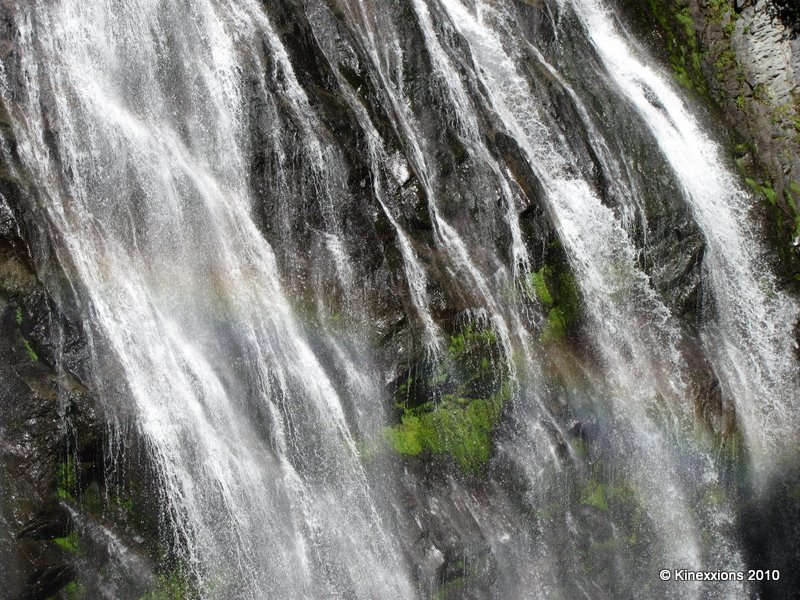
It is here, at Narada Falls, that the sparkling clear waters of Paradise River plunge over the edge of a cliff and drop dramatically 168 feet. The Paradise River runs clear, not milky, because it originates from snowfields, not debris-laden glaciers.

The trail to Narada Falls is only two-tenths of a mile long, but it is a 200 foot descent/ascent! It can be (and was) wet and slippery.

For some early visitors, the power of the waterfall suggested spiritual connections. They named it Narada after a powerful sage of Hindu mythology who acted as a messenger between human and divine realms. [National Park Service Sign]

It wasn't the biggest, or tallest, or widest waterfall I've ever seen. But it was one of the most beautiful and graceful.

There is a hint of a rainbow across the center of the falls.

The “drapery” of water opens and closes as it falls. It was enchanting.

Constantly changing as you watch, it is dependent upon the flow of water from above as well as the cliff face itself and the plants thriving there.

Thursday, September 16, 2010

Mount Rainier :: Perfect Timing!

Tuesday, September 14th - - It was mid-morning when I finally entered the southwestern side of Mount Rainier National Park. The morning had not been hopeful, awakening to cloudy skies once again. But luck was with me and as I drove toward the park the sun appeared and burned away the clouds. Quite a welcome change from my previous visit of a week ago, which was basically a drive-thru since I couldn't see anything at all due to the clouds, the fog, and the rain!

I forget the name of this creek but it was only a few miles into the park and it was the first view I had of Mt Rainier. Breathtaking.

This is a little further into the park. When the roads were constructed through the park the engineers took into account the “viewing pleasure” of the public and I must say they did an excellent job in selecting the sites for the viewpoints.

A couple of close-ups of the top of the mountain.


Probably the most visited area of the park is in the south-central part. It was about 12:30 in the afternoon when I arrived in Paradise and, as you can see, the clouds had moved in. I spent some time in the visitors center at Paradise - looked at the exhibits, viewed the park movie, then looked through the telescopes and saw three climbers halfway up the mountain.

The mountain played peek-a-boo with the clouds, but they eventually completely blocked out the view. I joined some of the other visitors on a short walk along one of the many trails in the area.

Mount Rainier and me!