Tuesday, August 31, 2010

Mendenhall Glacier

Thursday, August 26th - - Mendenhall Glacier, a short drive from downtown Juneau, was first named Auke Glacier in 1879 by John Muir. In 1892 it was renamed to honor Thomas Corwin Mendenhall (1841-1924) who served as Superintendent of the U.S. Coast and Geodetic Survey from 1889 to 1894.

The Mendenhall glacier flows for 12 miles down the Mendenhall Valley to its terminus near the visitor center. The ice flows forward at an average rate of 2 feet per day, but at the very same time, it wastes away at a slightly faster rate. Waste occurs through melting or when large pieces of ice break off the face of the glacier. When the rate of melting exceeds the rate of flow, a glacier recedes. The Mendenhall glacier has been receding since the late 1700's and currently retreats at a rate of 25-30 feet per year.

Mendenhall Glacier as seen from the rear of my campsite at Mendenhall Lake campground in the Tongass National Forest. The full face of the glacier cannot be seen from this vantage point because it is blocked by the bit of land jutting out from the left.

The view from the Visitors Center. We are seeing only a very small portion of the glacier as it extends 12 miles back down the valley.

A little bit closer.

An awesome waterfall flows down from above. Another waterfall can be seen in the far distance to the right of the glacier.

A ride on the lake gets you a little closer to the face of the glacier.

Some of the larger icebergs floating in Mendenhall Lake. Icebergs are created when the glacier calves (chunks of ice fall off the face of the glacier).

I couldn't resist picking up a chunk of glacial ice that was floating close to the shore. It was crystal clear and many, many years old. And it was cold...

Monday, August 30, 2010

The Marine Highway to Juneau

Wednesday, August 25th - - There are no roads to Juneau or to most of the other towns on the Inside Passage. The exceptions are Haines and Skagway on the north and Prince Rupert on the south. To get anywhere else you can fly or you can float. I chose the latter option.

Sitting on the dock of the bay... waiting to get on the ferry. I didn't have high expectations for wondrous views today. Rain. Again.

We're leaving the Haines Ferry Terminal, which is about five miles east of town. The ferry was quite large and is capable of carrying large RVs and trucks as well as passenger cars. There were several seating areas that were quite comfortable with spacious leg room. The voyage from Haines to Juneau takes about four and a half hours.

This is the oldest lighthouse in the Inner Passage that has not been remodeled. The only thing that has been done to it was to automate the light. It was about an hour and a half after leaving Haines.

The rain had finally stopped at around noon and the sky began clearing. The sun made its most welcome appearance shortly thereafter.

With the sun shining, it was quite pleasant walking around the deck. Not far from Juneau we saw quite a few whales, probably Orcas, all off in the distance. There were several “pods” that had five or six whales each. And not far away from them were the whale-watching boats. About all we could see of whales was when they spouted water into the air and occasionally a tail fin when one dived beneath the surface. Still, it was exciting to see them.

And now, we're coming into the Juneau Ferry Terminal. A portion of Mendenhall Glacier can be see in the center of the photo. Downtown Juneau is twelve miles to the south. I drove downtown to make arrangements for a cruise on Friday and found the parking garage, which also houses the Juneau Public Library on the fourth floor. There were some nice views of downtown and the waterfront, which was quite busy. Five cruise ships were at the docks! I knew that those things were big but just didn't realize how big. They dwarfed the four story library/parking garage building.

The view of Juneau from the front of the library.

And from the rear.

Sunday, August 29, 2010

Chilkoot River Bears

Caution... lots of photos...

Tuesday, August 24th - - I had noticed this sign yesterday on my way to the campground at Chilkoot Lake but didn't give it much thought. But this morning when I was leaving the campground, I noticed a bunch of cars pulled off along the road and people milling about with long telephoto lenses on their cameras. I stopped the car, grabbed my little point-and-shoot camera and walked over to see what they were looking at... these bears were outside the bear zone! Guess they don't know how to read ;-)

There was Mama bear and her cubs (could be the same ones that Sue and Fred saw a couple of days ago). There were three cubs, they just never all got together for a group photo...


Look at those claws! And it's just a baby...


This evening, as I was going back to the campground, there were some scattered rain showers and I was greeted by a double rainbow! To the east, the direction in which I was going, the sky darkened and it poured down rain.

Meanwhile, over to the west, the sun was shining. Ya gotta love it. Continuing on toward the campground, I noticed movement off to the side of the road, and then, what did appear before my eyes?

Why, Mama bear and her three little cubs! By the time I had grabbed the camera and turned it on, Mama was already across the road. (I was safely inside the van as they were way too close for comfort. This photo was taken through the windshield.)

Half an hour later, I left the gloomy campground (it is heavily forested and not much light gets through the trees, especially when it is cloudy) and went back into Haines for a while.

On my way, people were gathered in one area alongside the road so I stopped... Mama bear was there and at least two cubs. They were further away than those this morning and the cubs stayed close to the bank, hidden by the weeds and brush.


It was so neat seeing them like this, in their natural habitat. They went about their business, generally ignoring us humans, though they did check us out now and then.

Saturday, August 28, 2010

Moving On :: Kluane to Haines

Monday, August 23rd - - I continued on the Alaska Highway from Lake Kluane to Haines Junction where I turned south on the Haines Highway. Designated a National Scenic Byway, it is one of the prettiest drives in Alaska (in my opinion). What makes it different from all the other Scenic Byways is that you have scenic views that can actually be seen! They aren't completely hidden by rows of trees alongside the highway. The 150 miles from Haines Junction takes you through a portion of the Yukon Territory, British Columbia, and Alaska.

I didn't take many pictures along the way. Though pretty, the scenery didn't lend itself well to picture taking, and the further south I drove the cloudier it got. So you'll just have to take my word for it that it was beautiful.

There was some road construction and about 15 miles of gravel road, and my van, which had to go through two car washes in Anchorage to get clean, was now dirty again...

There were signs of autumn in the air, besides the chilly weather.


It had started raining about 30 miles north of the Alaska border and the rain continued all the way to Haines, 40 miles south of the border. I stayed at the campground at Chilkoot Lake State Recreation Area (which also happens to be where Sue and Fred stayed). It is ten miles east of Haines at the end of the highway.

Friday, August 27, 2010

Moving On :: Tok to Kluane

Sunday, August 22nd - - It is about 90 miles from Tok to the Canadian Border on the Alaska Highway. To get where I'm going (Haines) you have to backtrack a bit. Because of the terrain, your route options are limited - there aren't all that many roads in Alaska! (Reference the map at the bottom of my previous post.)

On my first drive through the area, the skies were gray and gloomy and it didn't really look all that pretty. But with somewhat blue skies and sunshine, things looked different this time around. There are so many small lakes and ponds dotting the landscape and with the mountains in the distance, it was quite nice.

You are probably getting tired of seeing reflections of the sky in the water, but I just can't help myself! I am captivated by them... a narrow view between the trees.

Even with the sunshine, there occasionally were a few scattered showers.

Once you get into Yukon Territory in Canada you are traveling on the absolute worst section of the Alaska highway! For nearly 100 miles you are jostled and jarred by dips and rises and jumbled pavement. If you are lucky you can get up to 45 mph in some sections but if you're not paying attention and you come to an area of bad pavement driving that fast you're in for an exciting ride!

I took several shots of the pavement but it just doesn't show what it was really like. See those yellow flags alongside the road? Those indicate dips in the highway. So while you are jostled from side to side with the uneven pavement, when you reach the dips you are also bouncing up and down. Throw in a few potholes and several really bad sections for a challenging ride! I was so happy to get through it unscathed.

I made it to the Lake Kluane (pronounced CLUE-AH-KNEE) area in late afternoon, and, remembering Sue's glowing report of the Cottonwood Campground, I stopped there for the night. It has to be one of the nicest campgrounds I've stayed in, not just on this Alaska trip, but anywhere!

The view from my campsite, looking south. Gorgeous. Forty-six miles long, Lake Kluane is the largest lake in Yukon Territory and the highway follows it on the west side for about half of its length.

A closeup of the mountains on the south side of the lake.

The next morning, the wind was calm and the sun was shining. And, of course, the reflections in the lake were amazing.

From the bridge on the west side of the south end. This is actually a river that feeds the glacial water into the lake.

Looking east. A narrow peninsula juts out from the western side of the lake.

The highway is at the base of that mountain, following the shoreline. Ten miles north of that point is the Cottonwood Campground.

Thursday, August 26, 2010

Slight Jaunt South on the Richardson...

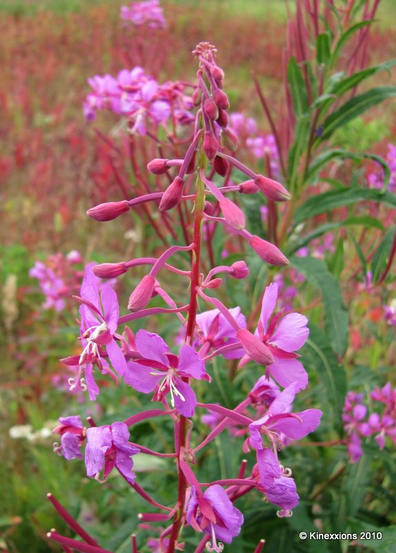
When I woke up early Saturday morning (August 21st) it was cold and foggy. Probably the coldest it has been any morning since being in Alaska. The fog was pretty thick but thankfully it wasn't at ground level. It seemed to be hovering about 15 feet above the ground.

From Glennallen, I headed south on the Richardson Highway (Route 4) towards Valdez. There really wasn't anything I wanted to see or do in Valdez but the Worthington Glacier was on the Richardson (85 miles south of Glennallen and about 30 miles north of Valdez) in the Chugach Mountains near Thompson Pass, which happens to be the snowiest place in Alaska. Besides, it was supposed to be a pretty drive. And it would have been except for the fog and the clouds.

You can see a little patch of blue coming through the clouds, promises of things to come. This is the Worthington Glacier, taken a few minutes before 9 o'clock. I don't know its dimensions. Lets just say that it's big!


The trail up to the top of glacier (a mile long with a 1200 foot elevation gain) was “officially” closed and warning signs were posted regarding the instability of the glacier and the area surrounding it. However, I saw several people scrambling over the rocks and hiking out to it, though they only went to the face of the glacier, not to the top. Two people can be seen in this photo, above and to the right of the trees. (Double-click on the photo to see a larger version.) If you are interested, in July 2004 several guys hiked to the top of the glacier. They have posted an entry with lots of neat photos at Natural Born Hikers.

If you look real close, you can see that two people are standing at the bottom edge of the glacier, in the center of the picture. Really.

Cropped and enlarged version of the previous photograph. Can you see them now?

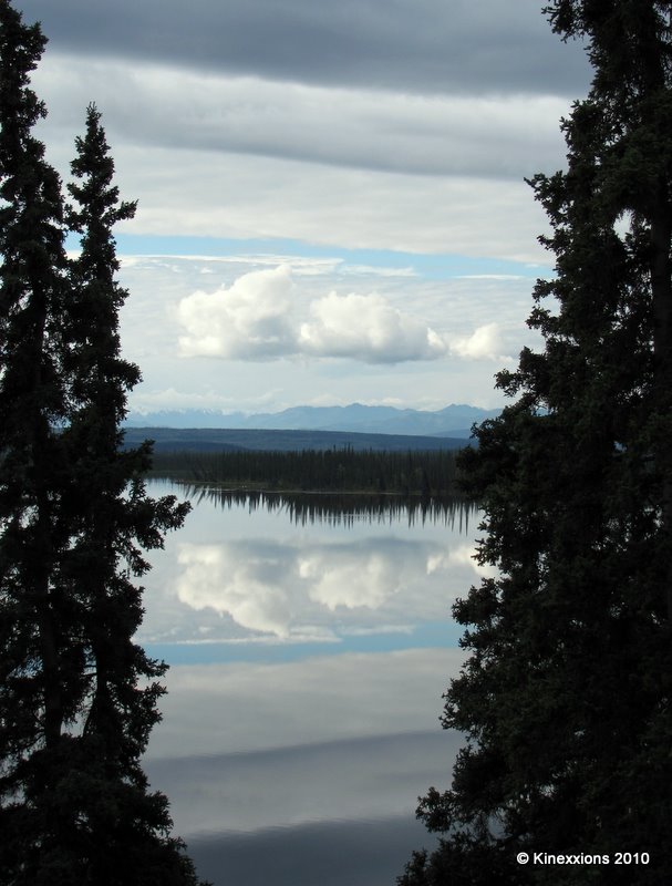
To the north and west, the skies were trying to clear. The little lake was formed when the glacier retreated. The drive back to Glennallen in the afternoon more than made up for the dreariness of the morning. Although clouds filled the sky, there was also plenty of sunshine!


The mountains are part of the enormous Wrangell-St. Elias National Park and Preserve.

This last shot was taken when I drove east for a few miles on Alaska Route 10 (Edgerton Highway), which goes to the town of Chitina, 34 miles away. The unpaved McCarthy Road begins at Chitina and ends in 60 miles at the Kennicott River. It's another half mile to McCarthy and five miles further to the town of Kennicott. (Visitors cross the Kennicott River on a footbridge, then walk or take a shuttle to McCarthy and Kennicott.)

“The Milepost” states that the McCarthy Road is recommended for those who like adventurous driving. Motorists should watch for sharp rocks, railroad spikes, no shoulders, narrow sections, soft spots, washboard, potholes and roller-coaster curves. You might think that railroad spikes would be an odd thing to have to be on the lookout for but the McCarthy Road was built on a railroad right of way after the railroad was torn up. You may also think that I'm adventurous, but foolish I'm not and I didn't even attempt to go down McCarthy Road.

The towns of Chitina, McCarthy, and Kennicott are the gateways to the Wrangell-St. Elias National Park and Preserve, which in reality, isn't accessible to the average person. It is wilderness in the truest sense and a haven for experienced backpackers and mountaineers.

Back on the Richardson Highway I stopped at the Visitor Center a few miles south of Glennallen and watched a 22 minute film. That is the only way that I and most people will ever be able to “visit” the park. It looks incredibly beautiful. Wrangell-St. Elias National Park and Preserve is the largest unit of the national park system encompassing nearly 24 million acres. It contains the greatest collection of peaks over 16,000 feet as well as the largest concentration of glaciers on the continent. It is also the reason why it is an almost 600 mile drive from Glennallen to Haines!

Homer is at the end of the Kenai Peninsula in the lower left. Haines is in the lower right corner, a driving distance of approximately 900 miles. The route from Valdez to Haines more or less follows the perimeter of the Wrangell-St. Elias National Park. Skagway is only 15 miles from Haines via ferry but is 300 miles via the highway! The yellow-highlighted routes are the roads that I've traveled thus far. (On the day this post was scheduled – August 24th - I was in Haines.)

I stopped for the night at Tok, which is at the junction of the Alaska Highway, in the middle of the map and 90 miles from the Canadian border.