I arrived at Chinook Pass a little before 9 a.m. and was more than a little intimidated by the view ahead of me! I slowly ventured into the fog and eased my way around the curves and over the pass. It looked like the valley was filled with fog too but a little further down the pass and the fog lifted to tree-top height. Driving visibility in the valley was actually quite good.
The "plan" for this morning was to find a campground to stay in for a few days. I took route 123 south to U.S. 12 where there is a large Forest Service Campground (La Wis Wis). It was a nice campground but the sites were close together and it looked to be pretty full. I continued south on U.S. 12 through the town of Packwood and on to Randle where I turned onto Forest Service road 25, which goes toward Mount St. Helens.
Ten miles from Randle I "discovered" Iron Creek Campground, a fantastic facility in the Gifford Pinchot National Forest. It was big with five loops and probably 150 sites. I picked out a site, paid the fee, and headed on up the road toward Windy Ridge and the eastern side of Mount St. Helens.
At Windy Ridge, I arrived just in time for the 2:30 p.m. Ranger Talk. She showed large, poster-sized photos of before and after the eruption giving a basic description of what happened on
Sunday morning May 18, 1980. The above photo shows Mount St. Helens in the distance with the top 1,000 feet of the mountain gone. The main difference I noticed between this visit and the one in September 2010 is how much more vegetation there is and how much more greener it is now.
Spirit Lake with a portion of the trees blown away by the eruption lining the shore.
One area of Spirit Lake is nearly filled with downed trees.
A zoomed-in view of one section of trees against the shore.
Another view shows the section of Mount St. Helens that was literally blown away during the first few seconds of the eruption.
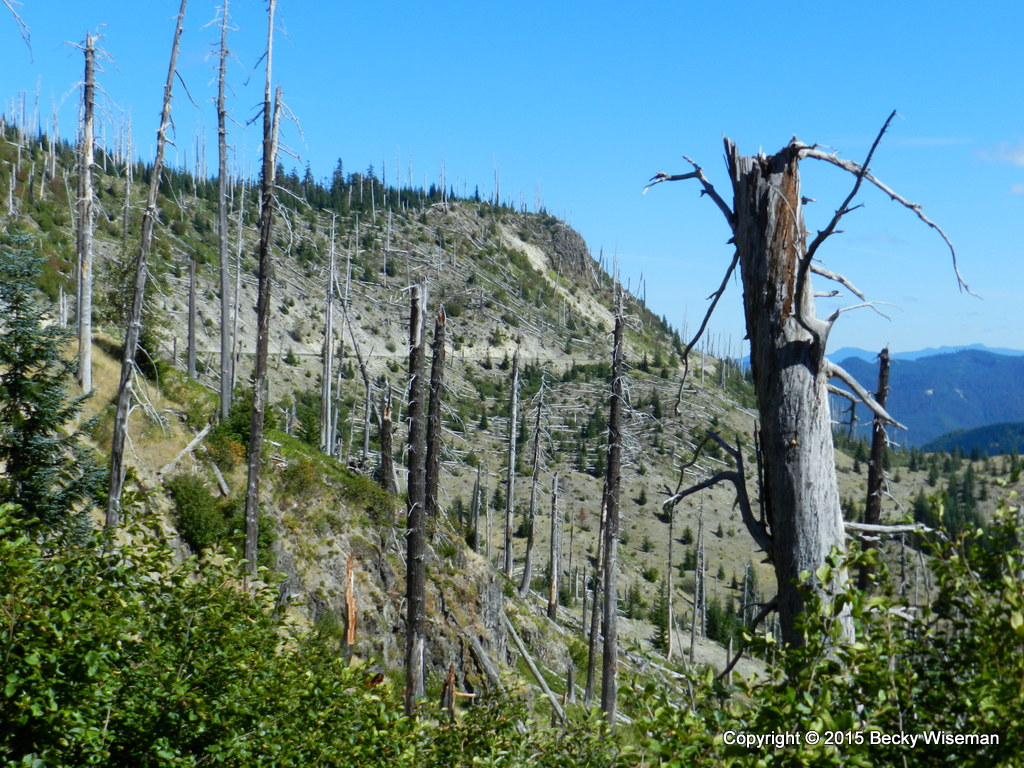
A portion of the "ghost forest" of trees left standing but with limbs and tops sheared off. This is on the eastern side of Mount St. Helens. On the north side, in the direct path of the initial blast the trees were laid flat. I did eventually get over to the eastern and north sides during this visit but that particular day the sky was filled with a smokey haze through which the mountain peak was barely visible. See
Mount St Helens :: 30 Years Later posted on September 13, 2010.
Published under a Creative Commons License.
Becky Wiseman, "Mount St. Helens - August 5th," Kinexxions, posted September 18, 2015 (http://kinexxions.blogspot.com/2015/09/mount-st-helens-august-5th.html : accessed [access date])


No comments:
Post a Comment